GeoLibre: An Open-Source Cloud-Native GIS Platform and Lightweight Cross-Platform Geospatial Tool

GeoLibre is an open-source cloud-native GIS platform enabling cross-platform geospatial visualization and analysis.
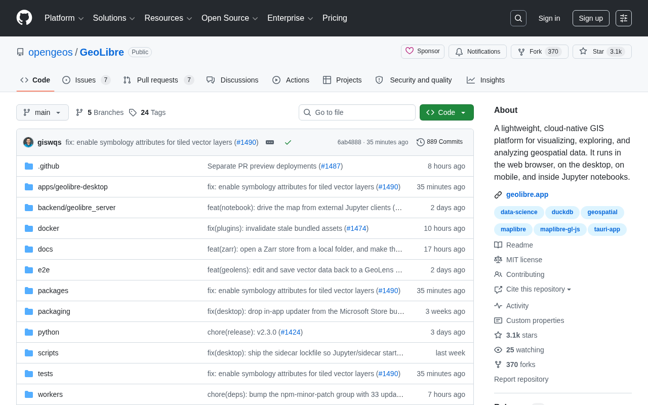
GeoLibre is a lightweight, cloud-native GIS platform built with TypeScript by the opengeos team. It supports deployment across web browsers, desktop, mobile, and Jupyter Notebooks, enabling geospatial data visualization and analysis without heavy installations. With 3,000+ GitHub stars and rapid community growth, it represents a shift from traditional heavy GIS software toward modern, cross-platform architecture that natively consumes cloud-optimized formats like COG and PMTiles.
A Geospatial Tool Exploding in Popularity on GitHub
In the field of Geographic Information Systems (GIS)—a domain traditionally dominated by commercial software—an open-source project called GeoLibre is rapidly catching the attention of developers. Maintained by the opengeos team, this project has accumulated 3,037 stars and 370 forks on GitHub, with a single-day spike of 420 new stars, making it one of the most watched open-source projects in the geospatial space recently.
Geographic Information Systems (GIS) represent a technology framework for collecting, storing, managing, analyzing, and displaying geospatial data. For a long time, this field has been dominated by Esri's ArcGIS product line, with enterprise licensing costs ranging from thousands to tens of thousands of dollars per year. Open-source alternatives like QGIS, while powerful and free, are typically desktop-focused and lack the flexibility of modern web applications. In recent years, driven by the explosive growth of remote sensing data (e.g., Sentinel satellites generating several terabytes of data daily) and urban digital transformation demands, GIS tools are facing pressure to transition from traditional desktop software toward cloud-based, lightweight solutions.
GeoLibre positions itself as a "lightweight, cloud-native GIS platform," with the core goal of making geospatial data visualization, exploration, and analysis simpler and more ubiquitous. Cloud-native is a methodology for building and running applications, with core characteristics including containerized deployment, microservices architecture, dynamic orchestration, and continuous delivery. In the GIS context, cloud-native means geospatial applications are no longer tied to specific operating systems or local hardware, but can elastically scale in any cloud environment. This stands in stark contrast to traditional GIS software, which typically requires installing bulky runtime environments locally and limits data processing to single-machine computing power. A cloud-native GIS platform can invoke computing resources on demand for large-scale spatial operations while achieving low-latency global access through CDN distribution.
GeoLibre is developed in TypeScript—a technology choice that itself signals its web-first, cross-platform design philosophy. TypeScript is a superset of JavaScript developed by Microsoft that adds a static type system to JavaScript. Choosing TypeScript for geospatial visualization has far-reaching implications: first, it natively runs in browser environments and can seamlessly collaborate with mainstream web map rendering libraries like Mapbox GL JS, Deck.gl, and OpenLayers; second, it can be compiled into desktop applications via Electron or Tauri, and mobile apps via React Native or Capacitor, truly achieving one codebase for multiple platforms; finally, TypeScript's type safety is particularly important for handling complex geospatial data structures (such as GeoJSON and vector tile protocols), catching common errors like coordinate system mismatches at compile time.
GeoLibre Core Features: Write Once, Run Anywhere
True Cross-Platform Deployment Capability
GeoLibre's biggest highlight lies in its deployment flexibility. According to the project description, it can run in four distinctly different environments:
- Web Browser: No installation needed—just open a webpage to use it
- Desktop: Runs as a standalone application
- Mobile: Supports phones and tablets
- Inside Jupyter Notebook: Seamlessly integrates into data science workflows
This "write once, run anywhere" capability is a direct embodiment of the cloud-native philosophy. For geospatial professionals, this means whether you're doing data analysis on a large screen in the office or quickly checking map data on your phone in the field, you can use the same set of tools and data workflows, greatly reducing the friction of switching between work environments.
Lightweight Design: Advantages Over Traditional GIS Software
Compared to traditional GIS software (like ArcGIS, QGIS) with installation packages often several GB in size, GeoLibre emphasizes being "lightweight." This is particularly important for cloud deployment and rapid iteration—lightweight means faster loading speeds, lower resource consumption, and easier embedding into existing web applications and data pipelines.
Modern geospatial analysis increasingly relies on large-scale remote sensing datasets and cloud-optimized data formats. Take the Copernicus program's Sentinel-2 satellite as an example—it performs multispectral imaging of the global surface at 10-meter resolution every 5 days. To cope with such massive volumes of data, the GIS field has seen a series of cloud-optimized formats emerge in recent years: Cloud-Optimized GeoTIFF (COG) allows clients to request specific regions and zoom levels of raster data on demand; PMTiles is a single-file vector tile archive format accessible directly through HTTP Range requests; and FlatGeobuf is a vector data format designed for streaming. The value of lightweight cloud-native GIS platforms like GeoLibre lies precisely in their ability to directly consume these modern formats without downloading data locally for processing, truly leveraging the advantages of being "lightweight."
Why Developers Should Pay Attention to GeoLibre
A New Force in the Open-Source GIS Ecosystem
The geospatial field has long faced a contradiction: commercial software is powerful but expensive and closed; while some open-source solutions are free, they often suffer from fragmented experiences and complex deployments. GeoLibre attempts to find a balance between the two—maintaining the openness of open source while providing a smooth experience approaching that of commercial products.
A notable detail: the opengeos organization itself has considerable reputation in the geospatial open-source community. opengeos was founded by Qiusheng Wu, a geography professor at the University of Tennessee, and has deep influence in the geospatial Python ecosystem. Its representative works include: geemap—a Python interactive mapping library based on Google Earth Engine with over 3,000 stars; leafmap—an interactive geospatial analysis library for Jupyter environments; and segment-geospatial—a tool applying Meta's SAM model to geospatial image segmentation. These projects share a common goal of lowering the technical barrier to geospatial analysis, enabling non-GIS specialists to efficiently process spatial data. GeoLibre can be seen as the team's strategic move to extend their accumulated design philosophy from the Python backend to the TypeScript frontend, bringing their experience from the Python ecosystem into the TypeScript/Web world.
Deep Integration with Jupyter Notebook
For data scientists, Jupyter Notebook support is a feature that cannot be overlooked. Jupyter Notebook is an interactive computing environment that allows users to mix code, execution results, visualizations, and text explanations in a single document. In the geospatial field, Jupyter has become the core working platform for researchers and data scientists, because geospatial analysis typically involves multi-step exploratory workflows—from data loading, coordinate transformation, and spatial queries to final visualization—each step requiring immediate feedback. Traditional GIS software encapsulates these steps in a GUI, making them difficult to reproduce and automate; whereas code cells in Jupyter naturally support version control and workflow reproduction.
GeoLibre's support for Jupyter means its rendering engine can be embedded in Notebooks as an ipywidget, allowing users to get an interactive map experience without leaving the analysis environment. This means users can complete the entire workflow of data cleaning, geospatial analysis, and interactive visualization in the same Notebook, without repeatedly exporting and importing data between different tools. This integration dramatically improves the efficiency of exploratory data analysis.
Typical Use Cases for GeoLibre
GeoLibre's cross-platform characteristics make it suitable for various scenarios:
- Urban Planning and Environmental Monitoring: Researchers can quickly build interactive maps to display remote sensing data or environmental indicators. For example, using Sentinel-2's multispectral data to calculate vegetation indices (NDVI), with real-time rendering and interactive exploration in the browser via GeoLibre
- GIS Education and Training: Since no complex installation is needed, students can learn GIS concepts directly in the browser—particularly valuable for educational institutions with limited resources
- Enterprise Data Dashboards: Lightweight and cloud-native characteristics make it easy to embed map visualizations into internal systems, seamlessly integrating with BI tools and business data pipelines
- Mobile Field Surveys: Instantly viewing and recording geographic data on mobile devices in the field, combined with GPS positioning for real-time data collection and annotation
Objective Assessment: Project Maturity and Usage Recommendations
Despite the impressive numbers, objectivity is warranted. As a rapidly growing new project, GeoLibre's feature maturity, community documentation, and production environment stability still need the test of time. While a single-day growth of 420 stars certainly demonstrates community enthusiasm, whether this enthusiasm can translate into long-term ecosystem prosperity depends on subsequent feature iterations, bug fix speed, and contributor activity.
From a technical perspective, several key questions need attention: How does rendering performance handle large-scale datasets? What is the level of support for OGC standard services (WMS, WFS, WMTS)? Is integration with existing spatial data infrastructure (such as GeoServer, PostGIS) smooth? These are critical factors determining whether it can replace mature tools in professional scenarios.
For developers looking to try it out, it's recommended to first test it in non-critical projects to assess whether it meets actual needs; for those seeking stable production environments, continue monitoring its version evolution and introduce it once the ecosystem is more mature.
Conclusion: GeoLibre Represents the Future Direction of GIS Tools
GeoLibre represents an important trend in geospatial tool development: moving from heavy desktop software toward lightweight, cloud-native, cross-platform modern architecture. It lowers the barrier to GIS usage, enabling more developers and researchers to conveniently handle geospatial data. As cloud-native concepts penetrate deeper across technology fields, and as cloud-optimized data formats like COG, PMTiles, and FlatGeobuf become more widespread, projects like GeoLibre that can efficiently consume massive spatial data directly in the browser are likely to reshape how we interact with geospatial data. For readers interested in geographic information, data visualization, or open-source tools, this is a project worth tracking.
Key Takeaways
Related articles

Should You Open Source Your Project? A Layered Open Source Strategy Using Project Replay as a Case Study
Should indie developers open source their projects? Using the game custom achievement tool Project Replay as a case study, this article analyzes the open source decision and offers a practical layered strategy.

130+ Open-Source Interactive Security Awareness Training: Reshaping Habit Formation Through 3D Office Scenarios
A project with 130+ free open-source interactive security awareness exercises using immersive 3D office scenarios to simulate phishing, vishing, MFA fatigue attacks and more, building employee security habits.

From Musk to Jefferson: Beware the Cognitive Trap of Cross-Domain Experts
Why do geniuses in one field often become overconfident in others? From Musk's controversial interview to Jefferson's blind spots, an exploration of cross-domain cognitive arrogance.