uGAP: An AI Platform Unifying 100+ African Geospatial Datasets
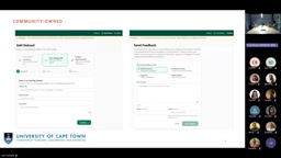
uGAP unifies 120+ African geospatial datasets with a catalog and Python SDK, helping local researchers move beyond coarse global models.
Ian Machola, a postdoctoral researcher at the University of Cape Town, introduced uGAP, a platform addressing the fragmentation of African geospatial data. It hosts 120+ open datasets across agriculture and land cover, offers direct download, spatial clipping, and imagery search, and ensures trustworthiness via ~34 metadata variables. Its Python SDK combines data discovery, processing, analysis, and ML training in one workflow, with plans to integrate TorchGeo pretrained weights. In the 2019 Cyclone Idai case, the team used only in-platform Sentinel-1/2 and auxiliary data to estimate flood extent and affected population. The platform strictly screens openly licensed data; community submissions require review. Currently all data comes from international satellites, and labeled data scarcity is the core bottleneck; the roadmap focuses on metadata interoperability, localized fine-tuning, and expanding labeled data.
The African continent is facing severe challenges brought by climate change—droughts, floods, and tropical cyclones occur frequently, yet fragmented geospatial data makes it difficult for local researchers to respond efficiently. In a recent tech talk, Ian Machola, a postdoctoral researcher at the University of Cape Town, introduced how the uGAP (Unified Geospatial AI Platform) integrates over 120 African geospatial datasets into a single workflow through a unified data catalog and Python SDK, helping researchers move away from reliance on coarse global models toward precise analysis based on local data.
The Fragmentation Challenge of African Geospatial Data
Machola has a background in atmospheric science and remote sensing AI. In his talk, he stated bluntly that Africa faces a fundamental contradiction when dealing with climate disasters: the continent emits very few greenhouse gases yet bears the most severe impacts of global warming. Over the past two decades, cyclones in Southern Africa, prolonged droughts in the Horn of Africa, and floods in Libya have repeatedly caused large-scale displacement and infrastructure destruction.
The prerequisite for responding to these disasters is data—knowing where phenomena occur, when they occur, and what data is needed. But in reality, African datasets are scattered across different institutions, stored in different formats, and locked behind different login permissions. When researchers want to conduct an analysis requiring multi-source data, they often hit a dead end at the data acquisition stage.
According to Machola's analysis, this situation forces researchers to settle for global products and models. These models have coarse resolution, making it difficult to capture micro-scale vulnerabilities such as African smallholder farms, and their support for local decision-making is limited. This is exactly where uGAP comes in: rather than producing new data, it makes existing data discoverable, accessible, and composable.
120+ Datasets and a Three-Tier Access Mechanism
The current uGAP catalog contains 120 open datasets covering major domains such as agriculture and land cover, of which about 24 are national-level datasets, plus regional-level data for the Congo Basin, East Africa, and other areas, as well as continental-level data. Machola acknowledged that there are still significant gaps in national-level data coverage, and it is precisely village- and community-level high-resolution data that is most critical for local decision-making.
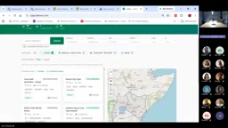
The platform offers three data access paths: direct download; selecting a country on a map and drawing a bounding box for spatial clipping and download; and filtering Sentinel, MODIS, and Landsat imagery by time window and cloud cover through an integrated search and archive function (linking to sources such as Planetary Computer). Each dataset comes with approximately 34 metadata variables, and the platform treats metadata completeness as the foundation of trustworthiness—missing metadata directly undermines data usability.
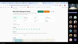
For nested datasets (such as West African mangrove forest cover spanning multiple countries), users can first select a specific country and check the data volume before downloading. Machola emphasized that the platform does not claim ownership of the data; all datasets come from published research or existing repositories, and users can trace them back to their original sources.
Python SDK: From Data Discovery to Model Training
If the catalog solves the question of "where the data is," the SDK solves "what to do after getting the data." uGAP packages all catalog capabilities into a Python library, layered with analysis functions and machine learning pretrained weights and architectures. After installing the library, users can list available datasets for a given country, call active data sources such as Sentinel, and complete discovery, processing, analysis, and training within the same workflow.
Machola mentioned that the team is advancing an embedded integration with TorchGeo, aiming to bring pretrained weights and geospatial model capabilities directly into the SDK, so that users can "get data, complete analysis, train models, and obtain final outputs through a single entry point." This distinguishes it from a mere data portal—according to his remarks during the Q&A session, uGAP not only lets users view data but also allows them to perform further analysis with the library, and the data types are not limited to raster and satellite imagery but also include vector and Excel-format spatial data.
TorchGeo is the official extension library for geospatial data in the PyTorch ecosystem, providing Dataset, Sampler, transforms, and pretrained models designed specifically for remote sensing imagery. It has built-in support for reading multi-source satellite imagery such as Sentinel-2, Landsat, and NAIP, and handles geospatial-specific engineering details such as geographic coordinate alignment, multispectral band normalization, and patch sampling. Embedding TorchGeo into the uGAP SDK means users no longer need to build the entire pipeline from image reading to model input themselves; they can directly call model weights pretrained on geospatial data and then fine-tune with local labeled data. This lowers the barrier for African researchers using deep learning for tasks such as land cover classification and flood detection, and avoids reimplementing data loading and augmentation logic.
Case Validation: Mapping Floods from 2019 Cyclone Idai
Machola demonstrated the SDK's real-world capabilities using the 2019 Cyclone Idai flood event in Mozambique. He selected an area about 1,000 square kilometers in size at some distance from the coast and completed flood extent estimation using only datasets already available on the platform, without introducing any external data.
The workflow was as follows: first, obtain vector data for roads, schools, and hospitals as well as land cover data through the SDK, using land cover to distinguish permanent from non-permanent water bodies to aid masking; then call Sentinel-1 radar data (which penetrates clouds and is suitable for flood mapping) and Sentinel-2 optical data, using backscatter and the MNDWI index to identify open water and water under vegetation cover, respectively; subsequently fuse the radar and optical information to estimate damaged buildings and affected population.
The analysis results showed that about 300 square kilometers were completely inundated, and based on data available at the time, an estimated 33,000 people lived within the flood-affected area. Machola specifically noted that the imagery used was collected several days after the disaster; if actual exposure during the period of sustained rainfall were considered, the number could be higher. The value of this case lies not in the numbers themselves but in proving that multi-source data can be assembled within a single library to quickly produce information usable for rescue prioritization and road passability assessment.
Sentinel-1 is a C-band synthetic aperture radar (SAR) satellite under the European Space Agency's Copernicus program. Its active microwave imaging does not depend on sunlight and can penetrate clouds, so it can still acquire surface imagery during severe weather events such as floods and typhoons. In flood mapping, calm open water surfaces specularly reflect radar backscatter energy away from the sensor, appearing as dark low-backscatter areas in the image and thus forming a sharp contrast with surrounding land. Sentinel-2 is a multispectral optical satellite under the same program, providing 13 bands from visible to shortwave infrared with a maximum spatial resolution of 10 meters. MNDWI (Modified Normalized Difference Water Index) uses the reflectance difference between the green band and the shortwave infrared band to enhance water signals, and also has good capability for identifying shallow and turbid water under vegetation cover. The two are complementary: radar penetrates clouds and rain to identify open water, while the optical index helps distinguish waterlogging under vegetation; fusing them improves the completeness of flood extent estimation.
Community Co-building, Licensing Compliance, and the Future Roadmap
The platform has a community engagement channel: users can submit data links (currently only URL form), report missing or corrupted data, and suggest improvements. The team has review thresholds for community submissions—whether the data comes from a traceable, reputable source and whether it is supported by relevant publications—to prevent arbitrary data from flooding in.
Licensing was one of the focal points of the Q&A session. Machola responded that there is a dedicated license field in the metadata, and the platform strictly screens for datasets that permit redistribution and have open licenses; for nested datasets spanning multiple countries, if some countries restrict distribution, the team continues to communicate with the data source providers. He also clarified that currently the community can only "suggest data locations" rather than upload data directly—the platform does not yet have a database, and data is always hosted in the original repositories.
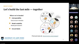
The roadmap has three priorities: expanding the metadata system to enhance interoperability (the team is building a geospatial extension based on the CryoCloud metadata developed by the NASA Middle Commons community); continuing to advance machine learning capabilities in the SDK, fine-tuning global models with the aggregated labeled data to adapt to local contexts, and validating model generalization stability across different African landscapes; and the most core challenge—acquiring more labeled datasets, which is the prerequisite for producing reliable predictions.
During the Q&A, Machola also revealed a key fact: of the 120 datasets, the vast majority come from international satellites such as Landsat, Sentinel, and MODIS, and there is no African indigenous satellite data yet. This reflects both the current state of Africa's Earth observation infrastructure and explains why uGAP chose to be an "aggregation layer" rather than a "production layer." When asked whether the data volume is sufficient, his answer was quite representative: Africa currently needs data more than stronger models; with high-quality data, existing models can serve local needs after fine-tuning.
From a broader perspective, uGAP attempts to answer a universal proposition for the Global South in the AI era: when computing power and foundation models are dominated externally, can localized data infrastructure become a fulcrum for autonomy? Machola's answer is to first connect the scattered data so that local researchers can reach them within the distance of a single line of Python code. The platform is still under continuous development but is already operational—this "usable unfinished product" may be exactly the starting point that African geospatial AI needs most.
Open licensing and redistribution is a core compliance issue in geospatial data sharing. Common open licenses include CC BY (Attribution), CC BY-SA (Attribution-ShareAlike), CC0 (Public Domain Dedication), and the Open Government Licence, among others, which allow users to copy, modify, and redistribute data provided conditions such as attribution are met. But satellite imagery and derived products often carry more complex terms: some national datasets prohibit cross-border transfer, commercial satellite products may restrict redistribution of derivatives, and licenses within multi-country nested datasets may be inconsistent. uGAP lists a separate license field in its metadata and screens for redistributable datasets before ingestion, precisely to ensure that platform aggregation and SDK calls do not trigger copyright or data sovereignty disputes. For cases where individual countries within a nested dataset restrict distribution, the team must communicate with the original data providers one by one, which also explains why the platform insists on hosting data in the original repositories and acting only as an indexing and access layer.
One-line Summary
uGAP integrates over 120 African geospatial datasets with a unified catalog and Python SDK, helping local researchers move beyond coarse global models.
Paragraph Summary
Ian Machola, a postdoctoral researcher at the University of Cape Town, introduced the uGAP platform, which aims to solve the fragmentation of African geospatial data. The platform contains over 120 open datasets covering agriculture, land cover, and other domains, offers three access paths—direct download, spatial clipping, and imagery search—and ensures trustworthiness with approximately 34 metadata variables. Its Python SDK encapsulates data discovery, processing, analysis, and machine learning training into a single workflow, with plans to integrate TorchGeo pretrained weights. In the 2019 Cyclone Idai case, the team used only in-platform Sentinel-1/2 and auxiliary data to estimate flood extent and affected population. The platform strictly screens for openly licensed data; the community can submit links but they are subject to review. Currently all data relies on international satellites, and the scarcity of labeled data is the core bottleneck. The roadmap focuses on metadata interoperability, localized model fine-tuning, and expanding labeled data.
Related articles

OpenAI Partners with Shield: How the Astra Agent Revolutionizes IT Troubleshooting
OpenAI and Shield launch the Astra agent, which autonomously logs into computers and legacy systems to fix IT issues in real time, 35-40% faster than traditional models, with humans involved only when judgment is needed.

iPhone Duo Battery Life Tested: One Charge a Day Is Unavoidable, and the Large Screen Is the Culprit
iPhone Duo battery test: heavy use needs at least one charge a day, and about 30% remains after 6.5 hours of screen-on time. How often the large screen is unfolded is key; a MagSafe battery pack helps, and long-term degradation is also worth watching.

Kimi K3.1 Pro Open-Sourced: 2.8 Trillion Parameters Close In on Opus
Moonshot releases the open-source MoE model Kimi K3.1 Pro, with 2.8T total parameters and 104B activated, trailing Opus 5.5 by under 1 point on Terminal Bench 4.0.