Unfenced: Finding Land for Sale That Borders Public Land

Unfenced uses public geographic data to filter land for sale bordering public land, showcasing a narrow-and-deep data integration product approach.
Unfenced is a project that sparked discussion on Hacker News' Show HN. It specifically filters land for sale adjacent to public land. In the western United States, the federal and state governments hold large amounts of land, and private parcels are often embedded among them. Being adjacent to public land means actually enjoying open space, but mainstream land platforms only filter by price, area, and state, leaving buyers to manually overlay maps for comparison. Unfenced's core work is spatially matching parcel boundaries with multi-source public land layers; the difficulty lies in aligning heterogeneous geographic data, unifying coordinates, and determining the boundaries between "bordering" and "adjacent." The article argues that the value of this kind of narrow-and-deep tool lies in using public data to fill a neglected niche dimension, but it is also limited by upstream data quality and regional coverage, making it suitable as preliminary leads rather than the basis for final decisions.
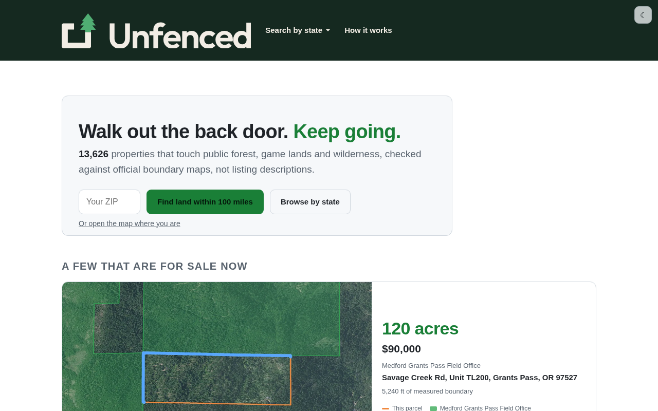
On Hacker News' Show HN section, a project called Unfenced drew attention: it does something very vertical — it specifically filters for parcels of land for sale that are adjacent to public land.
What Problem Does This Product Actually Solve
In places like the western United States, large amounts of land are held by federal or state governments, and private parcels are often scattered among public lands like a mosaic. For people who want to buy land to build a house, camp, hunt, hike, or run an outdoor business, "public land right next door" means a unique kind of value: you don't have to buy up a huge tract of forest yourself, yet you can effectively enjoy the vast open space next door.
The problem is that traditional land transaction platforms usually only filter by price, area, or state — nobody treats "does it border public land" as a core filtering dimension. Buyers can only stack maps layer by layer and compare them manually, which is time-consuming and laborious. Unfenced's entry point is precisely this information gap: it spatially matches parcel boundaries with public land layers and directly picks out the qualifying listings.
The Real Technical Difficulty: Not Scraping, But Geographic Data
From the outside, this looks like a "real estate website with an extra filter"; but the real workload lies in geospatial data processing.
The Fragmentation of Land Ownership Data
Ownership of public land is not unified: at the federal level it may involve different managing agencies, while states, counties, and even municipalities each hold land too, with different data formats, update frequencies, and coordinate precisions. To accurately calculate "whether this parcel for sale borders public land," you must first align, clean, and unify the coordinate systems of these heterogeneous layers.
U.S. federal public land is mainly managed by four major agencies: the Bureau of Land Management (BLM) oversees about 245 million acres, covering vast ranches and deserts in the West; the U.S. Forest Service (USFS) manages about 193 million acres of forest land; the National Park Service (NPS) and the Fish and Wildlife Service (FWS) are responsible for protected areas and wildlife habitat, respectively. In addition, state land trusts, counties, municipalities, and even Native American reservations also hold large numbers of parcels. These agencies each maintain independent GIS layers, often using State Plane coordinates or Web Mercator, and ownership boundaries are further complicated by legal divisions such as mineral rights, easements, and grazing permits. To unify them under the same spatial index, it is usually necessary to overlay the PLSS (Public Land Survey System) grid, handle parcel gaps and overlaps, and synchronize updates regularly — a workload far beyond that of an ordinary real estate website.
The Gray Areas of Boundary Determination
"Bordering" itself also has a granularity problem — does it mean sharing a boundary line, or merely being separated by a road or a river? Within how many meters does it count as "adjacent"? Such judgments directly affect result quality and also determine whether users trust the tool. In HN discussions, these definitional issues often attract more attention than the features themselves.
In GIS, determining "bordering" usually relies on topological relationships and buffer analysis. Determining a shared boundary requires the boundary lines of two polygons to coincide within a tolerance range, and this tolerance often needs to be set according to data precision (for example, 1 meter or 3 meters). If "adjacent" parcels are to be included, buffers are commonly used to generate distance bands, which are then intersected with candidate parcels. But in reality, linear features such as roads, rivers, and railways cross between two parcels, causing them not to share a boundary geometrically while being almost connected in practical use. Whether to include these parcels in the results and how wide to set the buffer will significantly change the number of filtered results and user expectations. Therefore, the product must disclose its spatial determination rules; otherwise, the same parcel may be classified as "bordering" or "not bordering" due to algorithmic differences, directly affecting buyer trust.
Why This Kind of "Narrow and Deep" Tool Is Worth Paying Attention To
The value of Unfenced is not in how cutting-edge the technology is, but in the fact that it demonstrates a still-effective product approach: do one sufficiently specific thing with public data right under the nose of mature large platforms.
There is no shortage of land transaction platforms, but "public land adjacency" is a niche dimension ignored by mainstream platforms, and it happens to correspond to a group of users with clear needs. Similar opportunities often hide in the gaps of data integration, not in an arms race of model capabilities.
For indie developers, the inspiration of this case is: rather than making yet another general-purpose tool, it is better to find a specific problem that "everyone has to check manually, but no one has turned into a product."
The feasibility of this kind of narrow tool based on public geographic data is closely related to the opening up of government data in recent years. Agencies such as the U.S. Department of the Interior, BLM, and USFS provide downloadable vector layers through platforms such as Data.gov, BLM Navigator, and the USGS National Map, and some states have also established their own GIS portals. At the same time, open-source spatial databases and analysis libraries such as PostGIS, GeoPandas, and DuckDB Spatial have greatly reduced processing costs, enabling individual developers to complete multi-layer overlays and spatial queries locally. Coupled with the maturity of front-end mapping tools such as Mapbox and Leaflet, visualizing results and delivering them to end users no longer requires a large team. It is precisely the maturity of this infrastructure that makes "doing one specific thing in the gaps of data" an accessible opportunity for indie developers.
A Rational Look at Its Limitations
The ceiling of this kind of tool is also quite obvious. The accuracy of geographic data depends on upstream sources; any error or omission in any layer may mislead buyers' judgments, and land transactions themselves are low-frequency, high-value, strongly regional decisions, so users have extremely low tolerance for errors.
In addition, market coverage is limited by data availability — regions with open data and high levels of digitization are easy to serve, while other regions are hard to cover. It is more likely to be a small and beautiful tool serving a specific region rather than a nationwide platform.
For people genuinely considering buying land, Unfenced is better suited as a source of leads for preliminary screening; the final decision still needs to combine on-site inspection and title verification.
One-line Summary
Unfenced uses public geographic data to filter land for sale bordering public land, showcasing a narrow-and-deep data integration product approach.
Paragraph Summary
Unfenced is a project that sparked discussion on Hacker News' Show HN. It specifically filters land for sale adjacent to public land. In the western United States, the federal and state governments hold large amounts of land, and private parcels are often embedded among them. Being adjacent to public land means actually enjoying open space, but mainstream land platforms only filter by price, area, and state, leaving buyers to manually overlay maps for comparison. Unfenced's core work is spatially matching parcel boundaries with multi-source public land layers; the difficulty lies in aligning heterogeneous geographic data, unifying coordinates, and determining the boundaries between "bordering" and "adjacent." The article argues that the value of this kind of narrow-and-deep tool lies in using public data to fill a neglected niche dimension, but it is also limited by upstream data quality and regional coverage, making it suitable as preliminary leads rather than the basis for final decisions.
Related articles

A Single Prompt Triggers a Global PHP Security Storm: Is AI a Savior or a Hidden Risk?
A single AI prompt triggered a global PHP security crisis affecting Wikipedia and the Internet Archive. This article reviews the incident, analyzes the OpenAI-Amazon controversy, and explores the security paradox of lowered vulnerability discovery barriers in the AI era and developer response strategies.

When AI Is Taken Away: How Reliance on Shortcuts Undermines Your Problem-Solving Resilience
A study of 1,222 people found that after using AI to answer questions, once AI was removed, people gave up on more problems than a control group that never used AI. The article analyzes the impact of AI reliance on learning resilience and metacognition, and explores design implications for AI learning tools.

Carta and NewView Partner to Let Startup Employees Cash Out Equity Early
Carta and NewView Capital partner to simplify startup tender offers, helping employees sell equity early. Analysis of the mechanism, liquidity pain points, and impact.