Flash Floods Strike Without Warning — How New Technology Buys Precious Time

New sensor, modeling, and alert technology aims to buy critical minutes before flash floods strike.
Flash floods are among the hardest disasters to warn against — storms can turn deadly in under an hour, and traditional forecasts fall short on spatial resolution, timing, and rural data coverage. Using Indiana resident Laura Lin's experience of being trapped mid-Zoom call as a starting point, the article explains why localized flash floods so often arrive without warning, and how next-generation systems combining IoT sensor networks, high-resolution real-time modeling, and direct personal alerts could close the gap. Technology alone isn't enough, though — getting warnings to people and ensuring they act on them is equally critical.
The Deadly Characteristic of Flash Floods: They Move Too Fast
What makes flash floods so dangerous comes down to one word: speed. They can erupt within minutes of heavy rainfall, before rivers, low-lying areas, and drainage systems have any chance to respond — and by then, water is already flooding yards, roads, and homes.
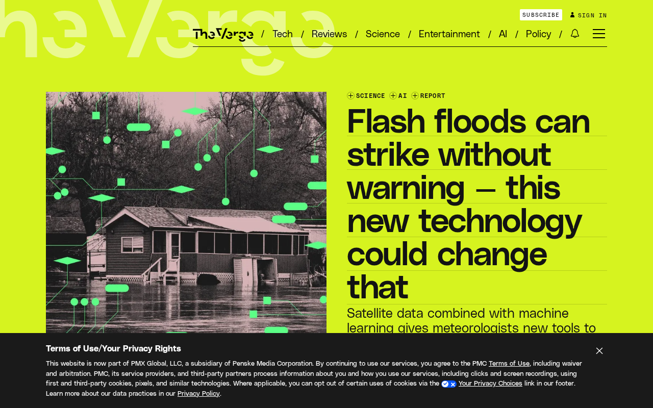
A scene from the original report captures this perfectly: on the morning of June 9, Laura Lin was at home in Lanesville, a small rural town in southern Indiana, in the middle of a Zoom call. A torrential downpour outside had already begun flooding her yard, but she had no idea — not until she glanced toward the barn and realized something was terribly wrong.
This "no warning at all" phenomenon is exactly what makes flash floods so difficult to manage. Traditional weather forecasts can tell you it's going to rain heavily today, but they struggle to pinpoint which specific creek or low-lying area will hit dangerous water levels at what exact time. For people living in rural areas, mountains, or along riverbanks, by the time floodwaters are visible to the naked eye, there may be only minutes left to evacuate.
Why Existing Warning Systems Fall Short
Flash flood warnings are difficult to issue for several technical reasons.
The Spatial Scale Is Too Small
Large-scale meteorological models are good at predicting regional precipitation, but flash floods tend to occur within very small geographic units — a single creek, a single valley. This kind of highly localized intense rainfall and runoff is hard for coarse-grid models to capture.
Meteorologists typically call this type of localized heavy rainfall "convective precipitation" — it may span only a few kilometers horizontally and last just an hour or two. National-level numerical weather prediction models (such as the GFS in the US or GRAPES in China) typically operate at horizontal resolutions of tens of kilometers. At that scale, an extreme rainfall event in a single valley can be averaged out and blurred, disappearing entirely from the model's output. Even finer mesoscale models like WRF, once the grid is shrunk to 1–3 kilometers, become computationally prohibitive to run in real time at scale. This "model resolution ceiling" is one of the fundamental physical reasons flash flood warning accuracy remains limited.
The Time Window Is Too Short
The gap between a downpour and a disaster can be mere tens of minutes — or even less. This means warning systems must achieve near-real-time data collection and analysis; any delay directly shrinks the time residents have to react.
Data Coverage Is Insufficient
Remote rural areas often lack dense sensor networks. A small town like Lanesville might have no real-time water level monitoring stations for miles around, creating serious information blind spots when disaster strikes.
What New Technology Is Changing
The report notes that emerging technology could transform the current inability to warn people about flash floods. While the original source doesn't expand on technical details, these kinds of systems generally attack the problem from several angles, based on where the disaster-preparedness field is heading:
Denser sensor networks — Low-cost IoT water level sensors and rain gauges deployed across rural and mountainous areas fill the monitoring gaps that traditional weather stations can't reach.
Localized real-time modeling — Using terrain data and real-time precipitation inputs, high-resolution flood propagation simulations can be run for specific watersheds, narrowing warnings down to the neighborhood or even individual household level.
Direct personal alert delivery — Once a model determines that a specific location is about to flood, the system can immediately push an alert to residents' phones and other devices, ensuring those precious few minutes for evacuation actually reach the people who need them.
For residents like Laura Lin, receiving a message early in the storm saying "flash flooding possible in your area within 30 minutes" could have made all the difference.
In the real-time modeling space, one of the most closely watched approaches is combining physical hydrological models with machine learning. Traditional hydrological models (such as HEC-RAS and SWMM) depend on precise terrain, soil, and vegetation parameters, making them slow to build and slow to run. Meanwhile, purely data-driven deep learning models are fast but their generalization under extreme scenarios remains questionable. Projects like Google Flood Hub and NOAA's National Water Model are exploring "physics-informed neural networks" — using machine learning to accelerate the solving of physical equations, aiming to deliver basin-wide forecasts in minutes while preserving physical interpretability. This hybrid architecture is widely considered the most promising direction for a practical breakthrough within the next few years.
Beyond Technology: The "Last Mile" of Warning Delivery
Worth reflecting on is this: the value of any warning technology ultimately depends on whether it reaches people and prompts action. Even the most accurate model is ineffective if its information never reaches residents — or if residents don't know how to respond when it does.
This means next-generation flash flood warning systems can't be purely a technical upgrade. They also need to solve the "last mile" problem: Are warning channels reliable? Is the information communicated clearly? Do residents have basic emergency awareness? Technology can compress the warning time gap — but what ultimately determines life or death is the choices people make in those few minutes.
Warning effectiveness research has a classic framework called the "Warning-Response Chain," which breaks the entire process into: Detection → Forecast → Issuance → Dissemination → Understanding → Trust → Decision → Action. Technological advances primarily affect the first two stages, but every subsequent stage can break down. Research shows that even when residents receive a warning, a significant proportion will still underestimate the risk and delay evacuation due to "normalcy bias" — the tendency to believe that disaster won't really happen to them personally. The wording of warning messages, the authority behind who issues them, and regular emergency drills therefore matter just as much as sensor density and model accuracy.
Conclusion
The sudden, explosive nature of flash floods has made them a persistent challenge in disaster preparedness. Laura Lin's experience of being surrounded by floodwater in the middle of a Zoom call illustrates the clear shortcomings of traditional warning systems when facing localized, fast-moving disasters. If new technology can achieve breakthroughs in monitoring density, real-time modeling, and targeted alert delivery, there is a real opportunity to transform "no warning at all" into "a few minutes' notice" — and when it comes to flash floods, those few minutes are a lifeline.
Related articles

Chain of Thought Isn't Just for AI: How Humans Can Use CoT to Improve Thinking Quality
Chain of Thought isn't just a prompt trick for large models. Starting from a Hacker News discussion, this article analyzes why CoT works for human thinking too, breaks down actionable ways to transfer it, and highlights the key differences between human CoT and machine CoT.
Cloudflare Teams Up with OpenAI: Closi…
Cloudflare Teams Up with OpenAI: Closing the Loop from Vulnerability Discovery to Defense with AI
Cloudflare uses OpenAI Daybreak to investigate security vulnerabilities and generate reviewable remediation plans, while developers use Codex to boost coding efficiency and quality.

Orca Multi-Agent Orchestration in Practice: A Guide to Parallel Collaboration with Claude and Codex
Orca is Stable AI's free open-source agent workbench supporting 34 agents like Claude Code and Codex in parallel. Learn its Git worktree isolation, multi-model orchestration, and mobile management.