Aircraft Noise as a Locator: New OSINT Technique Exposes Privacy Vulnerabilities

Using only faint aircraft noise in a video combined with public flight data, the filming location can be precisely reverse-engineered.
Researcher Colsto demonstrated an OSINT-based geolocation technique: extracting Doppler curves of aircraft noise from video backgrounds and cross-referencing them with public ADS-B flight tracking data to narrow the filmer's location to a very small area. The method requires no system intrusion and uses only public information, making it extremely stealthy—ordinary video uploaders may unknowingly expose their home address. Implementation requires audio processing and data analysis skills and depends on an environment where aircraft noise can be heard and continuous audio segments. The article recommends that users reduce risk by removing audio tracks, adding ambient sound effects, and delaying publication, and calls on platforms to consider automatic detection and warnings.
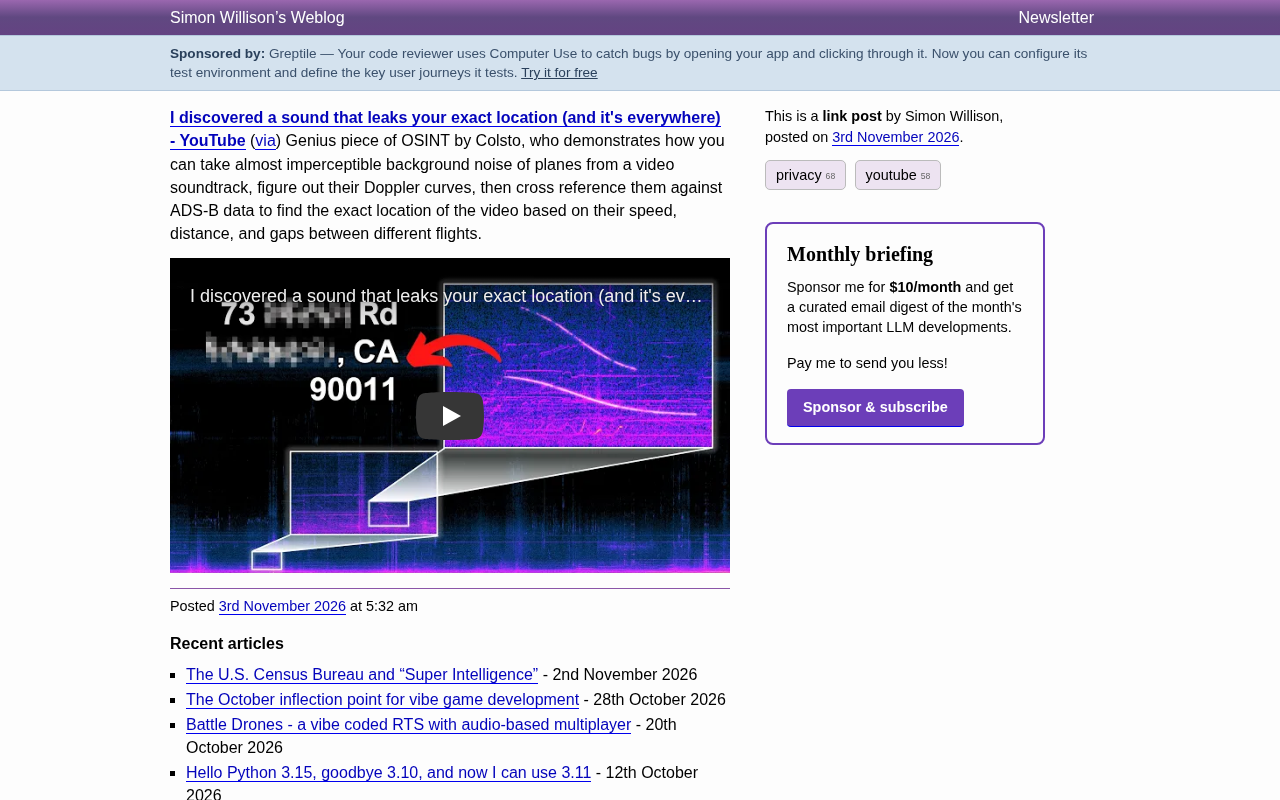
The background of a video you post may contain location information precise down to the street. Recently, a researcher named Colsto demonstrated a chilling OSINT (open-source intelligence) technique: using only the barely audible aircraft noise in a video, combined with public flight data, it is possible to reverse-engineer the precise location where the video was filmed. This technique requires no hacking—it relies solely on public information that anyone can access.
How Does Aircraft Noise Become a Location Clue?
The core of Colsto's method lies in the Doppler effect of sound. When an aircraft flies overhead, the pitch of its engine sound shifts subtly due to relative motion—rising as it approaches and falling as it recedes. The curve formed by this change is called a Doppler curve.
Although the background noise in a video is faint, modern audio processing technology is sufficient to extract these curves. Each curve corresponds to the flight trajectory of a specific aircraft. By analyzing the shape of the curve, it is possible to infer the aircraft's distance, speed, and direction of flight relative to the person filming.
The key is that this information does not exist in isolation. Global flight tracking data (such as ADS-B) is public and records the real-time position, altitude, and speed of every aircraft. By cross-referencing the Doppler curves extracted from the video with ADS-B data, it is possible to filter for aircraft flying in a specific airspace at a specific time. When the data of multiple aircraft match simultaneously, the filmer's location is narrowed down to a very small area.
The Doppler effect is a wave phenomenon proposed by Austrian physicist Christian Doppler in 1842: when there is relative motion between a wave source and an observer, the frequency received by the observer changes—rising when they approach each other and falling when they move apart. The most intuitive everyday example is the pitch of an ambulance siren dropping as it drives past. In aviation scenarios, the frequency shift of aircraft engine sound is proportional to the relative speed and the source frequency, so by measuring the pitch-change curve, the aircraft's kinematic parameters can be inferred. Notably, the Doppler effect applies not only to sound waves but also to light and radio waves; radar speed measurement and astronomical redshift measurement are all based on the same principle.
ADS-B (Automatic Dependent Surveillance–Broadcast) is an important technology in modern air traffic control. Aircraft automatically broadcast their position, altitude, speed, heading, and identification code via onboard equipment, and any individual with a suitable receiver can receive these signals for free. A large number of volunteers upload the received data to platforms such as Flightradar24 and OpenSky Network, forming a public global flight tracking database. It is precisely because ADS-B data is fully public and precisely time-stamped that it becomes the key data source for this kind of OSINT geolocation technique—attackers need no privileged access to obtain the precise trajectories of all flights in a given airspace during a specific time period.
The Power of OSINT and Privacy Risks
This technique falls under the category of OSINT, i.e., intelligence gathering using public information. It does not intrude into any system or crack any encryption; it simply cleverly combines public flight data with the ambient sound in a video.
According to Colsto's demonstration in the video, he was able to progressively narrow the location range by analyzing the time intervals and sound characteristics between different flights, ultimately determining the precise location where the video was filmed. What makes this method frightening is its stealthiness: the person uploading the video may be completely unaware that the faint aircraft roar in the background has already leaked their location.
For ordinary users, this means that when filming and uploading videos from a balcony, rooftop, or outdoors near an airport, they may inadvertently expose their home address. For sensitive professions such as journalists and activists, the risk is even higher.
OSINT (Open Source Intelligence) refers to the methodology of collecting, analyzing, and integrating intelligence from publicly available information sources, including social media, public databases, satellite imagery, news reports, and government public records. OSINT is not a new concept—intelligence agencies were already systematically analyzing public publications during the Cold War—but in the internet era its scale and efficiency have undergone a qualitative change. Unlike traditional intelligence methods, OSINT does not involve intruding into systems or cracking encryption and operates in a legal gray area—the collection itself is usually not illegal, but the combined information may constitute a serious privacy violation. In recent years, geolocation has been one of the most active branches of the OSINT community, and organizations such as Bellingcat have used similar methods to investigate military conflicts and criminal cases.
Technical Barriers and Limitations
Although the principle is clear, practical implementation requires some knowledge of audio processing and data analysis. First, the aircraft noise must be separated from the video's audio track, which requires that the background noise does not completely mask the aircraft sound. Second, extracting the Doppler curve requires precise audio analysis tools. Finally, matching with ADS-B data requires programming or the use of specialized software.
In addition, the method depends on several preconditions: the filming location must be able to hear aircraft noise (usually not too far from an airport or flight path); the video must contain continuous sound segments; and the flight data must be publicly available. In urban environments, if the background noise is complex, the extraction difficulty increases significantly.
Colsto also mentioned in the video that he is not the first to think of using aircraft noise, but no one had previously systematically demonstrated how to combine it with ADS-B data for precise geolocation. This reflects a trend in the OSINT field: as public data becomes richer, seemingly unrelated fragments of information can be combined to produce astonishing intelligence value.
How to Protect Yourself?
Faced with such privacy threats, ordinary users can take some simple protective measures:
- Mute or replace the audio track before uploading: If the video content does not depend on sound, removing the audio track is the simplest approach.
- Add ambient sound effects: Cover the original background sound with white noise or music, but be careful not to introduce new identifiable sounds.
- Avoid filming at sensitive locations: If filming is necessary, pay attention to whether there are obvious aviation noise sources nearby.
- Delay publishing: Publish the video after some time to reduce the risk of real-time geolocation.
For platforms, whether they should automatically detect and warn about such risks at upload time is also a topic worth discussing.
Conclusion
Colsto's demonstration reveals a neglected privacy leak channel: ambient sound. In an era where everything can be datafied, any seemingly harmless information can become a clue for geolocation. The technique itself is neutral; it demonstrates the power of OSINT and also reminds us that privacy protection requires more careful thinking. Next time before uploading a video, it may be worth listening to whether there is any aircraft roar in the background.
One-line Summary
Using only faint aircraft noise in a video combined with public flight data, the filming location can be precisely reverse-engineered.
Paragraph Summary
Researcher Colsto demonstrated an OSINT-based geolocation technique: extracting Doppler curves of aircraft noise from video backgrounds and cross-referencing them with public ADS-B flight tracking data to narrow the filmer's location to a very small area. The method requires no system intrusion and uses only public information, making it extremely stealthy—ordinary video uploaders may unknowingly expose their home address. Implementation requires audio processing and data analysis skills and depends on an environment where aircraft noise can be heard and continuous audio segments. The article recommends that users reduce risk by removing audio tracks, adding ambient sound effects, and delaying publication, and calls on platforms to consider automatic detection and warnings.
Related articles

Full AI Comic Drama Workflow with WorkBuddy: 8 Steps from Zero to Final Cut
A complete eight-step WorkBuddy workflow for making AI comic dramas: topic planning, script and storyboard, image assets, video generation, voiceover, editing, and publishing, plus WorkBuddy's expert-skill mechanism and tips for summoning experts one by one. Suitable for beginners.

Codex Practical Tutorial: From Installation to Multi-Agent Collaboration
Based on a Bilibili Codex practical tutorial, this article systematically covers installation and configuration, CLI interaction, slash commands, AGENTS.md architecture, the MCP protocol, multi-agent collaboration, and enterprise plugin development, helping developers understand engineering usage of AI Agents.

AI Agent Practical Guide: Building an Enterprise-Grade Agent from Scratch
A beginner-friendly guide to AI Agents: the difference from traditional programs, the perception-decision-action loop, technical evolution, the enterprise tech stack (LLM, tool calling, memory, RAG), and use cases.