LiDAR Reveals Ancient Cities: How Laser Technology Is Rewriting the History of Lost Civilizations

LiDAR technology reveals hidden ancient cities in Jordan and the Pacific, transforming our understanding of lost civilizations.
This article explores how Albert Lin uses LiDAR laser scanning, structured light scanning, and drone mapping to uncover lost civilizations featured in National Geographic's *Lost Cities*. In Jordan, LiDAR revealed 51 underground cisterns in the Nabataean city of Sela, solving the mystery of desert survival. In the Pacific, the technology stripped away mangrove canopy to expose hidden structures at Nan Madol, while field investigation debunked magical transportation legends with practical engineering explanations.
When explorer Albert Lin stood on a barren rocky plateau in the Jordanian desert, he wasn't holding an archaeological trowel — he was carrying a sophisticated LiDAR laser scanning system. The National Geographic special Lost Cities documents a journey using modern technology to reconstruct ancient civilizations — from the Nabataean city in Jordan to the Nan Madol ruins deep in the Pacific. This is not just an expedition; it's a dialogue between modern technology and ancient engineering wisdom.
LiDAR: The Archaeological Tool That Makes Deserts and Jungles "Invisible"
Albert Lin's core weapon is LiDAR (Light Detection and Ranging) technology. By emitting laser pulses and measuring reflection time, this technology constructs high-precision three-dimensional terrain models. Its most powerful capability is "penetration" — lasers can scan through dense jungle canopies, strip away vegetation cover, and even scan oceans to reveal structures hidden beneath the surface.
LiDAR technology was born in the 1960s alongside the invention of the laser, initially applied primarily to meteorological and atmospheric research. Its working principle involves emitting hundreds of thousands to millions of laser pulses per second, precisely calculating the round-trip time of each pulse (using the speed of light to determine distance), and generating dense 3D point cloud data. The revolutionary breakthrough in archaeology came in 2009, when researchers first used airborne LiDAR to scan the jungles of Belize, discovering numerous hidden Maya structures. Later, in 2016, LiDAR scanning of the area surrounding Cambodia's Angkor Wat revealed a medieval urban network dozens of times larger than previously known. The technology can "penetrate" vegetation because some laser pulses pass through gaps between leaves to reach the ground and reflect back. Software can separate "first returns" (canopy) from "last returns" (ground), generating a bare-earth Digital Terrain Model with vegetation removed.
As stated in the program: "Laser scans the desert, strips away dense jungle canopies, probes the ocean, revealing hidden worlds below." This capability is profoundly significant for archaeology. Traditional archaeology relies on manual excavation and field surveys — not only time-consuming but often impossible in areas with treacherous terrain or dense vegetation. LiDAR combined with drones can accomplish in days what previously required years of mapping work.

From Camels to Drones: High-Tech Meets Ancient Transportation
Interestingly, the expedition team transported LiDAR equipment up the mountain on donkeys and horses. Albert Lin marveled: "I've never carried LiDAR on the back of a donkey before… this is where high-tech meets ancient technology." This image is deeply symbolic — the most cutting-edge sensor technology ultimately still requires the oldest forms of transportation to reach those corners where human civilization once flourished but has since been forgotten.
The Ancient City of Sela: Nabataean Survival Wisdom Revealed by LiDAR Data
At the ancient city of Sela, 30 miles north of Petra, Albert Lin faced a central puzzle: how could a rocky plateau at 3,000 feet elevation, surrounded by desert with no water sources, support over a thousand residents?
The Nabataeans were an ancient people from the northern Arabian Peninsula who rose to prominence around the 4th century BCE and reached their peak by the 1st century BCE. Originally nomads, they controlled the frankincense trade routes connecting the Arabian Peninsula, Egypt, and the Mediterranean, accumulating vast wealth. Their most famous legacy is Petra — a city carved into sandstone cliffs, designated a UNESCO World Heritage Site. The Nabataeans' most remarkable technological achievement was their hydraulic engineering: in an extremely arid environment with only about 100mm of annual rainfall, they developed sophisticated systems of aqueducts, dams, and cisterns capable of capturing, directing, and storing every precious drop of rainwater. In 106 CE, the Nabataean Kingdom was absorbed by the Roman Empire, and their unique hydraulic knowledge gradually disappeared.
Visual observation yielded almost nothing — only scattered pottery shards and regular chisel marks on rock walls (later confirmed to be post holes for Nabataean tent structures). The real breakthrough came from holistic analysis of LiDAR data. Jordanian archaeologist Mohamed Najjar pointed out: "You need to look at the entire site together to understand how it functioned."

51 Underground Cisterns: Complete Reconstruction of an Ancient Rainwater Collection System
Scan data revealed water storage tanks carved into the rock — structures almost entirely invisible to the naked eye. Over three days of scanning, the team documented an astonishing 51 underground cisterns. This was the first time the complete rainwater collection system of ancient Sela had been revealed. By estimation, these artificial reservoirs could store approximately 200,000 gallons of rainwater — enough to sustain over 1,000 permanent residents.
This discovery rewrites our understanding of Sela: through masterful control of water resources, the Nabataeans transitioned from nomadism to settlement, establishing permanent cities in the arid rocky desert. Sela became a "stepping stone" toward the splendor of Petra, marking a nomadic people's "shift in consciousness" — from drifting like the wind to being deeply connected with the land.
Structured Light Scanning: Digitally "Returning" Artifacts to Their Origins
At the Jordan Museum in Amman, Albert Lin employed another technology — structured light scanning. Using the camera on his tablet, he scanned Greco-Roman style Nabataean statues to generate 3D mesh models: "I use the camera on my tablet to create what's called structured light… stacking a series of models into one complete model."
Structured light scanning is a non-contact 3D measurement technique. Unlike LiDAR's active laser ranging, it projects known light patterns (such as stripes, grids, or random dot arrays) onto an object's surface, then captures how these patterns deform on the surface from different camera angles. Through triangulation principles, software can precisely calculate the 3D coordinates of every point on the object's surface. This technology achieves extremely high precision, typically at sub-millimeter levels, making it particularly suitable for fine-detail recording of small to medium-scale artifacts. In museums and archaeology, structured light scanning's advantage lies in being completely non-invasive — no contact with artifacts is needed, no damage is caused, while generating high-precision digital models that can be used for research, display, or even 3D-printed replicas.
The value of this technology lies in "digital repositioning." At the excavation site of Herbet Eddaria, archaeologists discovered a city with a sacrificial temple — where Nabataean kings slaughtered sacrificial animals, with blood flowing down through "blood holes" in the altar. By merging aerial and ground scan data, the team achieved the first complete digital reconstruction of this lost temple, digitally "returning" museum statue artifacts to the temple facades they originally adorned.
Nan Madol: The Mystery of the Pacific's Aquatic Megacity
The program's second journey shifts to Nan Madol in Micronesia — an aquatic ancient city built approximately 600 to 800 years ago, hailed as an ancient wonder comparable to Easter Island and Machu Picchu. Today, however, the vast majority of the site has been swallowed by mangrove forests and is nearly invisible.
Nan Madol is located off the southeastern coast of Pohnpei Island in the Federated States of Micronesia and is one of the most important archaeological sites in the Pacific region. It was listed on the U.S. National Register of Historic Places in 1986 and designated a UNESCO World Heritage Site in 2016 (simultaneously placed on the endangered list). The site consists of 92 artificial islands covering approximately 75 hectares, built upon coral reef shallows. Its builders used an estimated 750,000 tons of basalt columns, which exhibit regular hexagonal cross-sections due to columnar jointing that forms naturally as volcanic rock cools. The Saudeleur Dynasty ruled the region from approximately 1100 to 1628 CE, with Nan Madol serving as their political and religious center. The largest single structure is Nandowas — a burial enclosure made of massive basalt stones, with walls approximately 7.6 meters high enclosing an area equivalent to a football field.
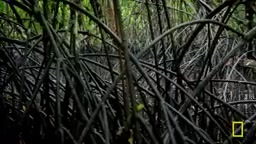
Facing this jungle-covered area of nearly half a square mile (equivalent to two Vatican Cities in size), the team planned over 40 drone flights to systematically scan in a grid pattern. When LiDAR data stripped away the canopy, hidden structures were revealed in full — including at least ten previously undiscovered buildings. Digital reconstruction showed a massive seawall protecting over 90 artificial islands, divided into burial zones and residential zones, demonstrating the authority of the ruling Saudeleur Dynasty.
Using LiDAR to Debunk the "Magic" Transportation Legend
Nan Madol's greatest mystery: where did those hexagonal basalt columns weighing 5 to 50 tons come from, and how were they transported? For centuries, local legends attributed it to magic.

Albert Lin discovered a "quarry in the sky" on the other side of the island — a 400-foot-high, nearly vertical basalt vein where the columns are identical to those at Nan Madol. Locals revealed the ancient extraction technique: "Burn wood, then pour water, and the stone cracks." This is actually the physical principle of thermal expansion and contraction — the ancients were effectively the "materials scientists and engineers" of their time.
Columnar jointing in basalt is a natural geological phenomenon: as high-temperature lava flows cool slowly, the rock volume contracts creating stress, forming a regular polygonal fracture network that ultimately produces hexagonal (occasionally pentagonal or heptagonal) columns. Famous examples include the Giant's Causeway in Northern Ireland and Devils Tower in Wyoming, USA. The "burn wood and pour water" quarrying method mentioned in the program is known in archaeology as "fire-setting," one of humanity's oldest mining techniques, documented in numerous ancient civilizations worldwide. The principle: flames heat the rock surface to several hundred degrees, minerals generate internal stress due to differing thermal expansion coefficients, then cold water causes rapid contraction, causing the rock to fracture cleanly along existing fissures (such as columnar joint planes). This method is particularly effective on columnar-jointed basalt with natural fractures, as thermal stress preferentially releases along joint planes.
As for transportation, Albert Lin proposed a hypothesis after surveying from the mountaintop: the ancients likely dropped the massive stones to the base of the quarry, then used waterways among the mangroves to float them out to sea, transporting them along the calmer waters inside the reef. This reasoning transforms the "magic legend" into a sophisticated marine engineering scheme.
From Individual Sites to a Macro View of Maritime Civilization Networks
The most profound insight brought by technology is revealing connections between civilizations. At Ant Atoll, 20 miles from Nan Madol, Albert Lin discovered the same basalt blocks and "sakau stones" used for ceremonies — materials not locally available, which could only have been transported from Pohnpei.
This means Nan Madol's influence extended across the ocean. The Saudeleur rulers and their successors, with superior navigation skills, established trade and cultural networks among the Pacific's more than 25,000 islands. As the program concludes, this place "is the product of multiple peoples meeting across the sea… somehow creating an oceanic continent."
Conclusion: When "Pixels Become Reality," Archaeology Enters a New Paradigm
Albert Lin has a phrase that runs throughout the program: "That's where pixels become reality." LiDAR, structured light scanning, drone mapping, and other technologies are opening entirely new possibilities for archaeology — they don't damage sites, can reach places humans cannot, and integrate fragmentary evidence into complete pictures of civilization.
Traditional archaeology has an inherent paradox: excavation is destruction — once a stratigraphic layer is opened, its original state is irreversibly lost. This is why modern archaeology emphasizes meticulous recording and stratigraphic excavation. Non-invasive technologies (such as LiDAR, Ground Penetrating Radar/GPR, magnetometry, structured light scanning, etc.) fundamentally change this paradigm: they can obtain vast amounts of information without touching the site. This methodological shift has multiple implications: first, it expands archaeological survey scale from traditional "localized test pits" to "landscape scale," revealing spatial relationships between sites and overall urban planning; second, it provides low-cost, high-efficiency recording methods for cultural heritage protection in developing countries and remote areas; finally, digitized data can be shared among scholars worldwide for repeated analysis, democratizing archaeological research. It's estimated that millions of archaeological sites globally remain unsystematically recorded, while climate change and urbanization threaten their survival at unprecedented rates.
The significance of these technologies extends far beyond the visual spectacle of expedition programs. They represent a paradigm shift in research: from relying on chance discoveries and localized excavation to systematic, non-invasive digital archaeological reconstruction. When ancient engineering wisdom meets modern sensor technology, we see not just lost cities, but the spirit of exploration and engineering ambition that has remained constant across thousands of years of human history.
Related articles

roastme.gg: How a Counterintuitive Product That Charges Users to Get Publicly Roasted by AI Engineered Viral Spread
Deep dive into roastme.gg's product design: users pay $1-$1000 to get publicly roasted by Claude AI, leveraging leaderboards and social cards for viral spread. Exploring AI entertainment business models.

TruIntel Review: An Analytics Tool for Monitoring Brand Visibility in AI Search
TruIntel is a brand visibility analytics tool for AI search, tracking how brands are cited in ChatGPT, Gemini, and Perplexity responses. Deep dive into GEO trends and practical value.

New Orleans Uses AI to Triage 911 Calls: How Smart Dispatching Is Changing Emergency Response
New Orleans deploys AI to triage backlogged 911 calls using speech recognition and emotion analysis. Explore how AI dispatch works, its risks, and impact on public safety.