Sentinel-2 Achieves New Breakthrough in 0.5m Canopy Height Synthesis
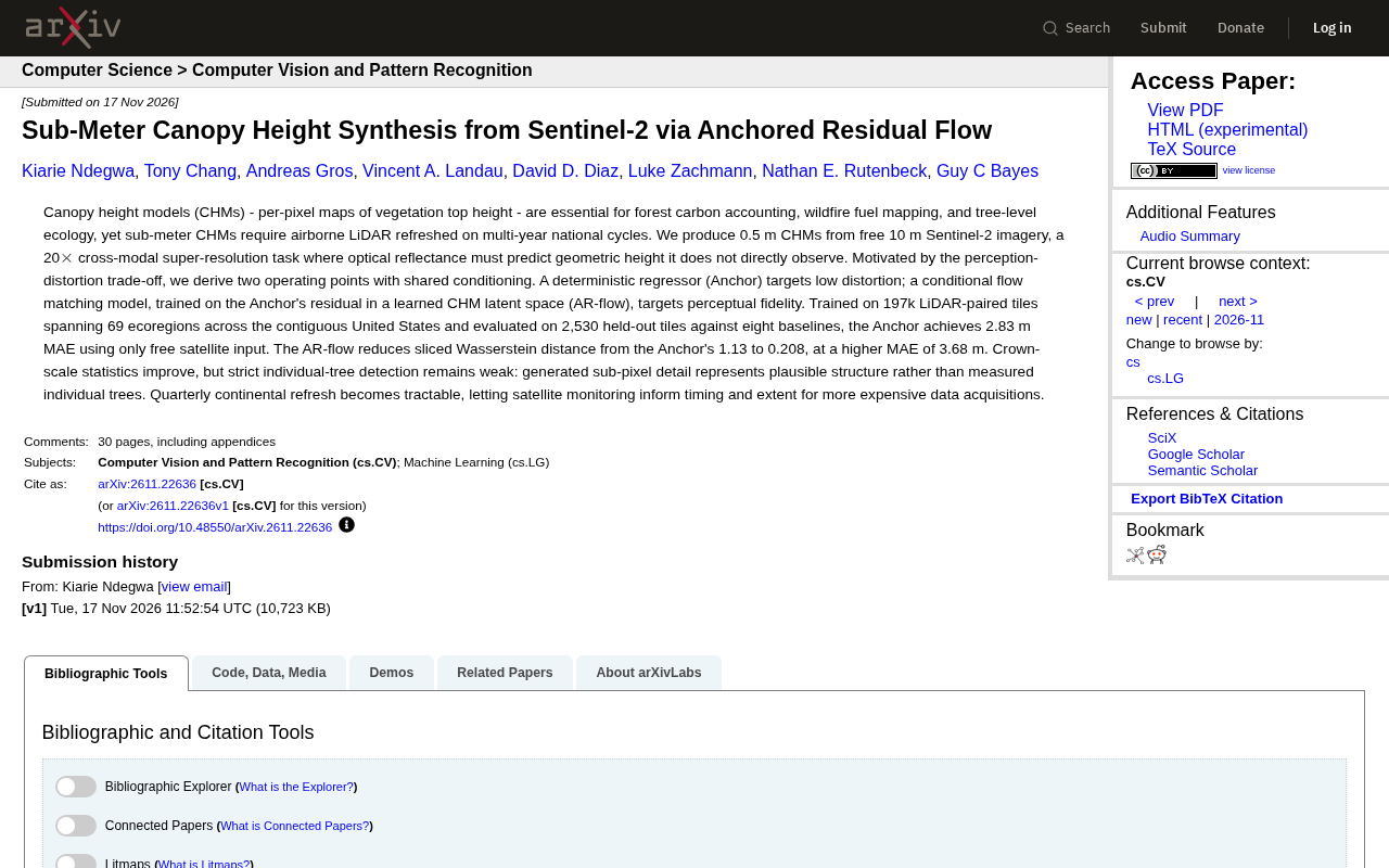
Researchers use an anchored residual flow model to generate 0.5 m canopy height maps from 10 m Sentinel-2, achieving 20× super-resolution.
The study proposes an anchored residual flow model to generate 0.5 m canopy height models (CHMs) from free 10 m Sentinel-2 imagery, achieving 20× cross-modal super-resolution. Based on the perception-distortion trade-off, it designs two operating points: the deterministic regressor Anchor pursues low distortion with an MAE of 2.83 m on 2,530 held-out tiles, while the conditional flow matching model AR-flow is trained on Anchor residuals and reduces sliced Wasserstein distance from 1.13 to 0.208, though MAE rises to 3.68 m. The model was trained on 197k LiDAR-paired tiles covering 69 ecoregions in the contiguous United States. Although the generated details are visually plausible, individual tree detection remains weak, making it better suited for regional-scale forest structure monitoring. The technique enables quarterly continental-scale CHM refreshes, can guide the timing and scope of expensive LiDAR acquisitions, and improves the timeliness of carbon accounting.
Why Sub-Meter Canopy Height Maps Matter So Much
Canopy height models (CHMs) are per-pixel maps of vegetation top-of-canopy height, and they are indispensable for forest carbon accounting, wildfire fuel mapping, and tree-level ecological research. However, sub-meter CHMs typically rely on airborne LiDAR, and LiDAR data is limited by national-scale acquisition cycles that occur only once every several years, making frequent updates difficult. According to a recent study, researchers attempted to generate 0.5 m CHMs from free 10 m Sentinel-2 imagery—a 20× cross-modal super-resolution task in which optical reflectance must predict geometric height that it does not directly observe.
Canopy height model (CHM) is a specialized subset of the digital surface model (DSM) that records, pixel by pixel, the height of the vegetation top (including tree crowns and shrub layers) relative to the ground. It is usually generated from airborne LiDAR point clouds: ground points are first separated and interpolated into a digital terrain model (DTM), and then the elevation of all return points is subtracted from the DTM to obtain the vegetation height in each grid cell. Unlike the DTM, which reflects only terrain relief, and the DSM, which includes all surface features such as buildings, the CHM is the most direct remote sensing representation of forest vertical structure. In carbon accounting, CHMs can be combined with allometric equations to estimate aboveground biomass; in wildfire management, they are used to calculate canopy volume and fuel continuity. Because LiDAR pulses can penetrate the canopy and directly measure three-dimensional geometry, their accuracy is far higher than that of passive optical imagery, but acquisition costs are high and revisit cycles are long—exactly the gap this research attempts to fill with Sentinel-2 optical data.
Methodological Innovation: The Anchored Residual Flow Model
Based on the perception-distortion trade-off, the research team designed two operating modes that share conditioning points. A deterministic regressor (Anchor) pursues low distortion; a conditional flow matching model (AR-flow) is trained on the Anchor's residuals in a learned CHM latent space and pursues perceptual fidelity.
Division of Labor Between Anchor and AR-flow
According to the paper, Anchor uses only free satellite inputs and achieves a mean absolute error (MAE) of 2.83 m when evaluated on 2,530 held-out tiles. AR-flow reduces the sliced Wasserstein distance from Anchor's 1.13 to 0.208, but MAE rises to 3.68 m. This trade-off reflects the compromise that generative models make between detail restoration and numerical precision.
Sliced Wasserstein distance (SWD) is a metric for measuring the difference between two high-dimensional distributions. It projects high-dimensional samples onto multiple random one-dimensional directions, computes the Wasserstein distance between the resulting one-dimensional distributions, and averages them. Compared with per-pixel error, SWD is more sensitive to the shape, variance, and texture statistics of the overall distribution, so it is often used to evaluate the perceptual quality of generated images. In this study, AR-flow reduced SWD from Anchor's 1.13 to 0.208, indicating that the canopy height distributions it generates are statistically closer in form to real LiDAR data, even though per-pixel MAE increases. This metric difference intuitively reflects the perception-distortion trade-off: Anchor excels in numerical accuracy, while AR-flow excels in distributional fidelity.
Training Data and Scale
The model was trained on 197k LiDAR-paired tiles covering 69 ecoregions in the contiguous United States, demonstrating the potential to generalize across ecoregions.
The perception-distortion trade-off is a core theoretical result in the field of generative models: for a given generative task, perceptual quality (such as detail realism and texture naturalness) and distortion (such as per-pixel error relative to ground truth) cannot both be optimal at the same time; improving one usually comes at the expense of the other. In super-resolution tasks, pursuing low distortion (such as minimizing MSE) leads to overly smooth outputs and loss of high-frequency details, whereas pursuing perceptual fidelity (such as with GANs or diffusion models) may generate structures that are visually realistic but numerically deviate from the ground truth. Based on this, the study designed two operating points: the deterministic regressor Anchor at the low-distortion end and the conditional flow matching model AR-flow at the high-perception end, both sharing conditional inputs so that users can choose according to application requirements.
Flow matching is an emerging class of generative modeling methods that enables sampling by learning a continuous-time velocity field from a simple prior distribution (such as Gaussian noise) to the data distribution. Compared with diffusion models, flow matching has a more direct training objective (regressing the conditional velocity field), is more sampling-efficient, and does not rely on complex noise schedules. In this study, AR-flow performs flow matching in the latent space of CHMs, conditioned on the Anchor's predictions—that is, it learns a "residual flow": the transformation path from the Anchor output to the true CHM. This design anchors the generation process near a physically plausible regression solution, avoiding the generation of spurious structures completely detached from the input imagery while retaining the ability to generate fine-grained textures.
Ecoregions are geographic units delineated based on climate, topography, soil, and vegetation characteristics. The 69 ecoregions in the contiguous United States span a wide range of variation, from temperate broadleaf forests in the East and pine forests in the Southeast to coniferous forests and arid shrublands in the West. Training a single model across such diverse ecoregions requires it to learn generalizable cross-regional features rather than memorize the canopy height distribution of a particular forest type. The 197k LiDAR-paired tiles provide large-scale supervision signals, enabling the model to capture the complex mapping between optical reflectance and canopy height under different phenological, canopy closure, and terrain conditions. During evaluation, 2,530 tiles were held out to ensure that performance metrics reflect generalization to unseen regions rather than overfitting to the training set.
Performance Evaluation and Limitations
In comparisons with eight baselines, Anchor achieved a 2.83 m MAE using only free satellite inputs, standing out in performance. Although AR-flow has higher MAE, it significantly improves canopy-scale statistical metrics. Nevertheless, strict individual tree detection remains weak: the generated sub-pixel details represent plausible structures rather than measured individual trees.
The Bottleneck of Individual Tree Detection
The researchers point out that although the generated sub-pixel details are visually plausible, they are insufficient to support precise individual tree localization. This means the technique is better suited for regional-scale forest structure monitoring than for fine-grained tree-level ecological research.
Application Prospects: Quarterly Continental-Scale Refresh
This technology makes quarterly continental-scale refresh feasible, and satellite monitoring can guide the timing and scope of more expensive data acquisitions. For example, in wildfire fuel mapping, high-frequency CHM updates can help prioritize LiDAR flights.
Significance for Forest Carbon Accounting
Despite its limitations, generating 0.5 m CHMs from free satellite imagery greatly reduces data acquisition costs and time delays, and is expected to improve the timeliness and spatial coverage of carbon accounting.
Conclusion
Through the anchored residual flow model, this study provides two operating points within the perception-distortion trade-off, opening a new path for sub-meter canopy height synthesis. Future work may focus on improving individual tree detection capabilities and extending to more ecoregions.
Related articles

Gemini 4 Neon Review: Benchmark Scores Rival Carbon, API Pricing and Quota Breakdown
Google Gemini 4 Neon is now live, benchmark scores closely tracking Carbon, API pricing 3/15 at twice Hydrogen's rate. This article compiles Bilibili creator testing: Neon can replace 90% of Carbon scenarios, AntiGravity quota consumption is only one-third of Carbon, plus subscription channel restrictions and 2API ban risks.

Gemini 4 Helium Coming Soon? Signals of Google Loosening Subscription Restrictions
Google team member hints releases will continue; community speculates Gemini 4 Helium (Flash Lite) may be next. Subscription ban controversy gets a response as product lead says "Soon," suggesting restrictions may be lifted. This article covers Gemini developments, OpenAI Coding Agent and risk management, Doubao real-time audio-video API, and compute business dynamics.

AI-Assisted React Development in Practice: Optimizing a Video App and Handling Errors
A 14-year veteran developer demonstrates AI-assisted React video app optimization: compressing video from 80MB to 5MB (~94%) via ImageKit, plus reliable error handling and retry mechanisms. Includes planning, code understanding, and verification methods for working with AI.